Uncategorized

Not all Heroes wear Capes (or Academic Gowns)

This week saw the announcement of the death of Philip Davis. It will pass unremarked upon by the national press, and I expect nearly all the readers of this blog will not have heard the name.

But you really should have heard of him, and I hope steps can and will be taken to preserve his legacy.

Those of us who grew up before the internet age and the widespread use of computers had to learn a different set of practical skills than today. When I began my training as a surveyor, much of our time was spent either in the drawing office, working on drafting skills on a drawing board with pencil and set squares, or outside in the field gaining practical experience in collecting dimensions using chains and tapes.
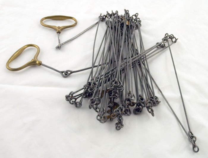
chainA Surveyor’s Chain

Although we had pocket calculators, our lecturer used a slide rule (https://en.wikipedia.org/wiki/Slide_rule) for calculations, and would produce an answer far quicker than us and our frenetic button manipulation. Our time on the computers was an hour a week, using a very simple drawing programme to join (literally and figuratively) the dots on the screen.

When I moved disciplines from surveying into archaeology, and went to Bournemouth University, I revelled in the Copac computer terminals. I could search for journals and books without having to flick through a paper catalogue and I would begin to remember where certain items were to be found on the shelves.

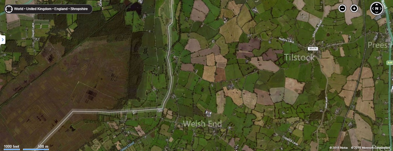
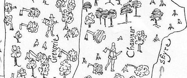
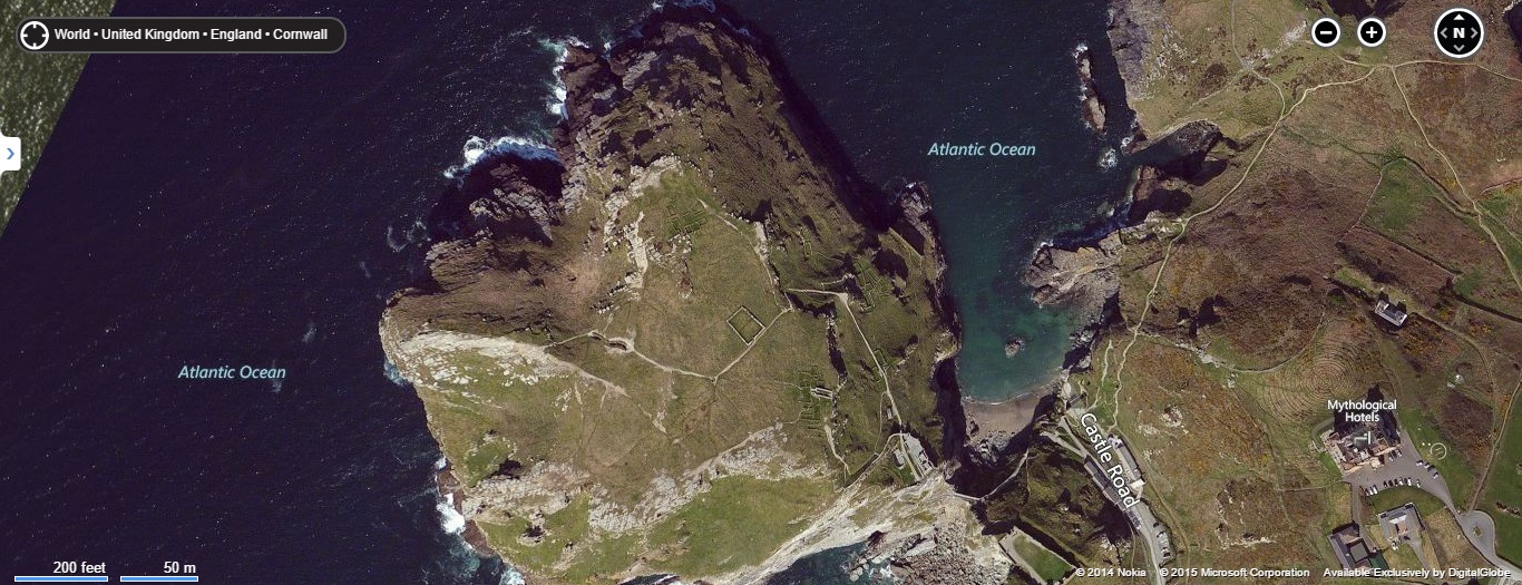
There was also the internet. In the mid 1990s it was not the academic resource we know today, but one of the earliest websites I used regularly was ‘The Castles of Wales’ (http://www.castlewales.com). As an expat living over the border in England, here I could explore the archaeology and history of Wales and begin to formulate ideas about the direction I wanted my academic research to take.

Another early site was the English Heritage Geophysical Survey Database, which was created in 1995 to provide a publicly accessible index of all the geophysical surveys of archaeological sites undertaken by them. The website itself no longer exists, but you can explore elements of it here, archived by the Archaeology Data Service: http://archaeologydataservice.ac.uk/archives/view/ehgsdb_eh_2011/

Which leads us to Philip Davis.

santamar

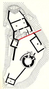
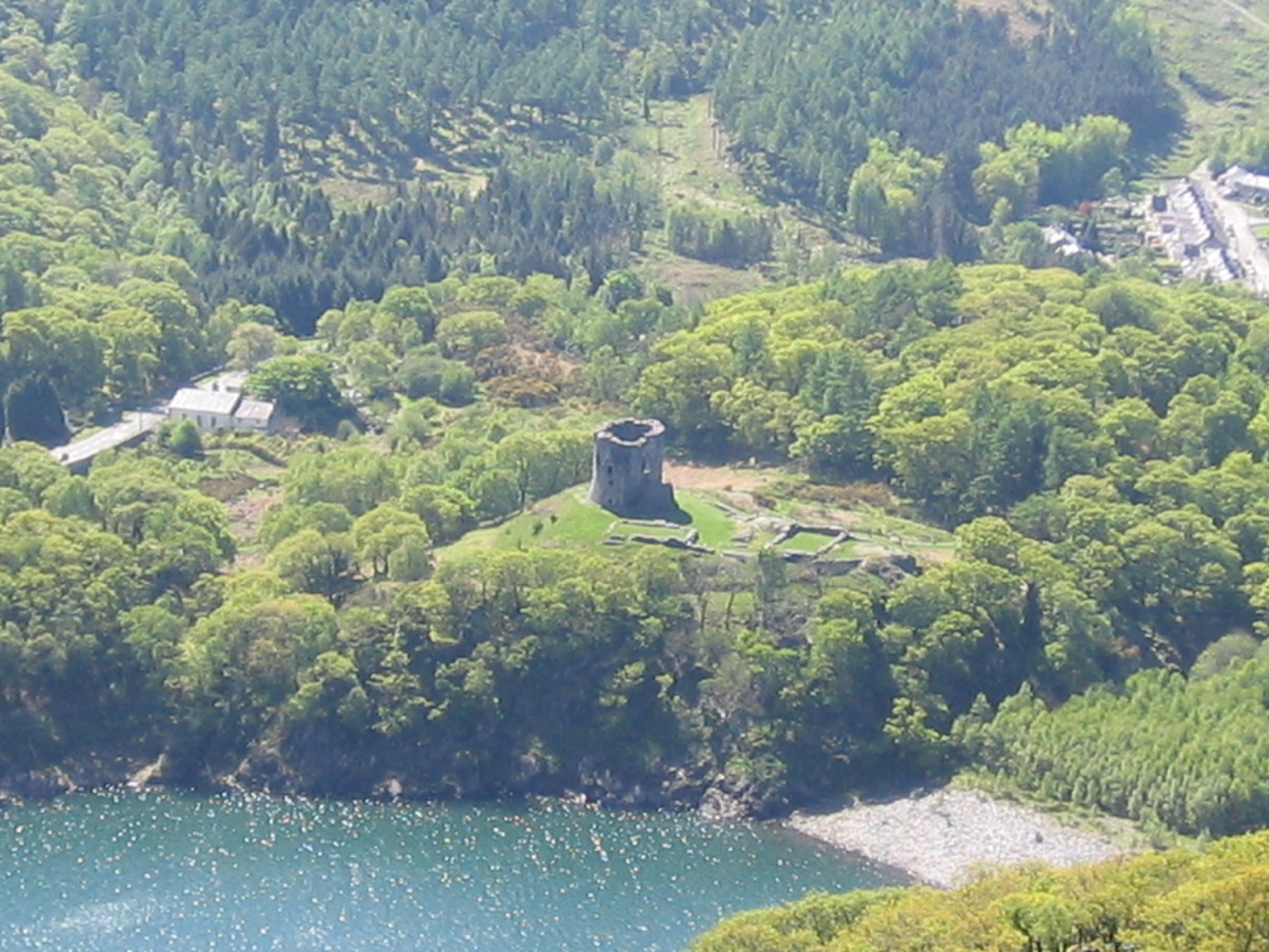
In the 1990s Philip created and curated ‘Gatehouse’, a website he described as The comprehensive online gazetteer and bibliography of the medieval castles, fortifications and palaces of England, Wales, the Channel Isles and the Isle of Man.

It is a phenomenal piece of research.

http://www.gatehouse-gazetteer.info/home.html

By his own admission, Philip was an amateur with no academic qualifications in his chosen field of study, but Gatehouse was, and is, the first port of call for any one interested in researching the history and archaeology of castles. Its breadth and depth of material is quite astonishing, with every castle having an entry, and every entry containing a considerable amount of detail. Drawing on national and regional databases, to which he added additional information, it is the kind of resource I could only dream of twenty years ago. Somehow, if steps have not been taken already to do so, this website should be curated and kept accessible for all to use.

I last saw Philip in June. He and I attended a study weekend in Oxford on Medieval and Tudor Gardens. We sat and talked in a courtyard next to the lecture theatre, where we each complimented the other’s work and happily passed the time.

I will miss him.


Uncategorized

Finally. The Big Reveal!…

After it all being very quiet on here, I can finally reveal what has been happening behind the scenes of the blog. I’ve been offered a book deal, and I am now writing ‘Medieval Parks and Gardens’ for the publishers Pen & Sword https://www.pen-and-sword.co.uk

Thank you.

I’ve received a phenomenal amount of support to get this far, so it’s only right I should thank people publicly for this. And now, let’s put some flesh on the bare boned facts above. After my operation in 2016 I had to take some time off to recover, only to find I needed another big operation in early 2017 to empty both kidneys of stones. This one really knocked me about and all my writing plans for PhD and publications had to be put back in the ‘to-do’ pile.

But it wasn’t all bad. A chapter I’d written entitled ‘Property not Prophecy: Welsh ‘Outlaws’ Owain Lawgoch and Owain Glyn Dŵr as High Status Landowners’ was published in early 2017:

9781472479914

https://www.routledge.com/Robin-Hood-in-Outlaw-ed-Spaces-Media-Performance-and-Other-New-Directions/Coote-Johnson/p/book/9781472479914

which had been a long time coming (the conference was held in 2011), and it paired with a paper ‘What does a Mercenary Leave Behind? The Archaeological Evidence for the Estates of Owain Lawgoch’ given in 2005 and published in the conference proceedings in 2008.

28414

http://www.brill.com/mercenaries-and-paid-men

As the ‘Outlaw/ed Spaces’ book was being published, I submitted two other papers. The first was a paper for a county journal entitled, ‘The History and Archaeology of the Medieval Park of Llwydcoed, Flintshire’. Llwydcoed is a park which is often referenced by medieval historians because of the detailed descriptions of its creation, including a description of how large it was and the number of gates into it.

As for its exact location, well, it tended to be a vague metaphorical wave of the hand to say ‘Oh, it’s somewhere in Flintshire’…

However, with a bit of research, and some lateral thinking, I located Llwydcoed in the landscape and also some features within it, including a moated site.

The second had originally been presented to the 4th Garden History Society Graduate Symposium in 2014, entitled: ‘Rills and Romance: Gardens at the Castles of Llywelyn ab Iorwerth and Edward I in Wales’. It was then rewritten and expanded before being presented at the Symposium by the Sea (SBTS) at Swansea University in 2015. A book, comprising the papers presented at SBTS is due out at the end of 2017 entitled ‘The Medieval and Early Modern Garden in Britain: enclosure and transformation, c.1200-1750‘, published by Routledge.

After the double operation, my PhD tutor helped me suspend my studies so I could get my breath and my strength back. As I was recovering I received an e-mail from a friend of mine who was now working as a Commissioning Editor for the publishers Pen & Sword. She suggested that I should put together a submission to write a book containing all the research I had undertaken to date and submit it to her. After thinking about whether I could cope with the writing workload (on top of my day job with the Gwynedd Archaeological Trust http://www.heneb.co.uk) and discussing with some of my contemporaries who are also currently writing or have already written books I decided it was something I would be able to accomplish within the agreed timeframe.

Currently the plan is to produce a book which draws upon both the latest archaeological and historical research, and which will also help archaeologists and historians locate ‘missing’ parks and gardens by presenting case studies to highlight what to look for.

I’ll post my writing progress here, and again, thank you, I couldn’t do this without your support.


Archaeology, Cymru, Europe, Ewrop, History, Uncategorized, Wales

New Shoots and Tree Roots

Apologies for the lack of activity. I have been chronically unwell (again). That, coupled with the shear volume of material I had collected, and unfortunately also curated, meant I felt I had nothing constructive to offer by the way of a blog post. Finally however, my last operation – hopefully for a while at least – will be on the 22nd of April 2016, so I expect to be able to write happily unencumbered by the usual ever growing rock army of kidney stones.

In among all this internal excitement I have also moved house. We (my wife and our three cats) now live in the flat which used to belong to my paternal grandparents. Built in the 1970s, it is light, bright and airy and most importantly my desk is now by a big window rather than tucked away in the far corner of the last place we lived.

As part of the moving in process I decided I would re-establish the container garden my grandfather maintained, and pots and soil in hand I planted up some heather and lavender and replanted my wife’s strawberry plant. As I stood and admired my handy work from the kitchen window, arm deep in washing up suds, I decided I would work on the material for my PhD chapter on gardens. It is by far the weakest chapter in terms of content and structure, but the strongest in terms of the new discoveries I have made during the research process. Unfortunately, many of these ideas have gone straight into the lecturing notes and Power Point presentations, rather than into the chapter as they should have.

Last summer I was fortunate enough to be one of two archaeologists working on an archaeological excavation in Rhuddlan (Latitude 53.288595; Longitude -3.463749). I’ve blogged about Rhuddlan previously, see:

https://medievalparksgardensanddesignedlandscapes.wordpress.com/2013/08/11/our-dark-garden/

and

https://medievalparksgardensanddesignedlandscapes.wordpress.com/2014/06/01/the-medieval-magic-in-pit-t349/

for some context to the area of North Wales I’m talking about.

The excavation was undertaken for a client who had planning permission to build a new house within a medieval burgage plot directly opposite the north-west corner of the Edwardian castle [A burgage was a town rental property owned by a king or lord. The burgage usually, and distinctly, consisted of a house on a long and narrow plot of land with a narrow street frontage]. A preceding archaeological evaluation, which examined only a small percentage of the total area of the site found medieval and post-medieval pottery and hints of some kind of ditch system within the plot.

Documentary research established that the front of the burgage plot was now lost under part of a row of nineteenth century cottages, but the rear of the plot, as far as all the evidence indicated had been unencumbered by buildings and appeared to have always served as a garden in one form or another. My fellow archaeologist and I employed the services of a mechanical excavator to remove the considerable overburden dumped on the plot from the building of both the cottages at the front of the plot but also from the construction of another row of nineteenth century cottages to the western side of the plot.

The archaeological excavation of the medieval deposits revealed that the rear of the plot had not been occupied by a property, but had served as open space within which over the following centuries a series of pits and ditches had been dug, some of which had animal bone within them. However it was something far more ephemeral which was uncovered that I was more excited about for my PhD research.

The natural ground surface (that is the surface into which we find cut the earliest archaeological deposits on any site) was on one part of the site imprinted with the ends of tree roots. This was where a tree had established itself within the soil higher up than the natural and had then tried to extend its tree roots through the natural. In this case, the natural was a very hard and impermeable clay, meaning the tree roots left ‘dents’ as it tried to force its way into the ground.

Tree Roots Not Marked
The site post excavation (after all excavation had been completed). Rhuddlan Edwardian Castle is at the top of the picture. Scale 1x1m.
Tree Roots Marked
The indentations within the red circle are those left by the tree roots as they tried to push through the natural clay.

Why are tree root indentations exciting? The Edwardian castle garden was only 80 metres (262 feet) away and planted on identical geology. Although all above ground evidence, except for the well within the garden has disappeared, the excavations reveal the kind of archaeological evidence we should expect if an excavation on the site of the Edwardian Castle garden was undertaken. And I haven’t given up on the idea that I could be the person to lead and carry out that excavation.

FURTHER INFORMATION:

My Manchester Metropolitan University page – which describes the aims and objectives of my PhD research:

http://www2.mmu.ac.uk/hpp/research/current-phd-students/

You can also help fund my research – which has reached its original funding target. However if you like what you read, then you can still donate.

http://www.gofundme.com/medievalgardensandparks

My Academia.edu page – where you can download my published research:

http://mmu.academia.edu/SpencerGavinSmith


Uncategorized

Down among the Detail: Tilstock Park – Part Two

My Manchester Metropolitan University page – which describes the aims and objectives of my PhD research:

http://www2.mmu.ac.uk/hpp/research/current-phd-students/

Please help fund my research – which is just over 50% funded to date:

http://www.gofundme.com/medievalgardensandparks

My Academia.edu page – where you can download my published research:

http://mmu.academia.edu/SpencerGavinSmith

In my blog post last week https://medievalparksgardensanddesignedlandscapes.wordpress.com/2015/02/01/the-trees-of-tilstock-park/

I looked at Tilstock Park on the Shropshire / Flintshire border (Longitude 52.931698; Latitude -2.710032) outlining its history.

Tilstock Park Today
Tilstock Park Today

This week I’m going to look in detail at some of the areas within the park which should provide archaeological information based on a map of c.1600.

Tilstock Park c.1600 - map rotated to place North at the top
Tilstock Park c.1600 – map rotated to place North at the top

By placing the map of c.1600 side by side with a modern aerial photograph it is possible to see that the map is a very accurately drawn, suggesting that is has been derived from a surveyors measurements.

The map of c.1600 and a modern aerial photograph side-by-side

In order to map Tilstock Park I used a programme called Grid Reference Finder http://gridreferencefinder.com to mark the boundary of the park, the location of the fish ponds, the location of the park lodges, the location of the ‘Green’ and the location of the park gates. The points marked can then by exported to the programme Google Earth.

The finished map is presented below.

Tilstock Park c.1600 mapped accurately onto Google Earth
Archaeology, Art History, Cymru, Europe, Ewrop, History, Literature, Poetry, Shropshire, Sir Amwythig, Wales

The Trees of Tilstock Park

My Manchester Metropolitan University page: http://www2.mmu.ac.uk/hpp/research/current-phd-students/

Please help fund my research: http://www.gofundme.com/medievalgardensandparks – just over 50% funded to date.

My Academia.edu page: http://mmu.academia.edu/SpencerGavinSmith

This week we are on the Shropshire / Flintshire border looking at Tilstock Park (Longitude 52.931698; Latitude -2.710032). The earliest date for a park at Tilstock is 1361 when it is recorded in an ‘Inquisition Post Mortem’. An Inquisition Post Mortem recorded the lands held at their deaths by tenants of the crown.

If want to know more – have a look at http://www.inquisitionspostmortem.ac.uk: “The project will publish a searchable English translation of the IPMs covering the periods 1236 to 1447 and 1485 to 1509. From 1399 to 1447 the text will be enhanced to enable sophisticated analysis and mapping of the inquisitions’ contents. The online texts will be accompanied by a wealth of commentary and interpretation to enable all potential users to exploit this source easily and effectively.”

Back to our particular Inquisition taken in 1361, which was taken on the death of Ankaretta Lestrange. Although the park is not recorded prior to 1361, it must have been in existence prior to this date for it to be included. From 1361 to the end of the century there are records of the Parkers (those officials responsible for maintaining the parks) but in this post I want to look at the ‘death’  of the park, rather than its ‘life’.

During my research I found this image which was published in Rowley, T. 1972 ‘The Shropshire Landscape’, Hodder and Stoughton, London.

Tilstock Park c.1600
Tilstock Park c.1600.

(The annotations are mine on a photocopy before anyone thinks the book was defaced!)

This map – produced c.1600 – shows the ‘death’ of Tilstock Park. With the trees being chopped down by men equipped with axes. Having looked at this map in the book, I wasn’t happy with the reproduction of the original as some things didn’t look quite right, and it said in the book there there was no north marked on it.

Annotations on a copy of Tilstock Park c.1600
Annotations on a copy of Tilstock Park c.1600.

I thought I’d use my copy as it shows my ‘workings out’, and gives some idea of how I look for clues, both in maps and in the landscape. Firstly, the original map does have north marked on it, it just happens that it is written in Latin.

Latin words for 'North', 'South', 'East' and 'West' around the edge of the original map
Latin words for ‘North’, ‘South’, ‘East’ and ‘West’ around the edge of the original map.

Septentrionales = North / Meridies = South / Oriens = East / Occidens = West

Another way of orientating the map would be to look at where the county of Flintshire is marked, and in this case the county of Flintshire should be to the west of the county of Shropshire. So, with the map orientated, what other clues can we glean from the map?

Tilstock Park in its final incarnation had two gates, one on the western side and one on the eastern side. The gate on the western side had a park lodge outside of the park on the northern side, and there was another building in the north western corner of the park. On the southern side of the park was a water gate which allowed the flow of water to be controlled into a series of fish ponds on the south eastern side.

Fish Ponds in Tilstock Park
Fish Ponds in Tilstock Park.

Rowley thought that the park was divided into three – and in the ownership of Greene, Chawner and Gregorie. However, although Chawner and Gregorie appear to be depicted on the map, with axes over their shoulder, there is no sign of Greene. It would appear that in this case Greene refers to an open space, something we would expect to find in a medieval park.

Chawner and Gregorie depicted with axes
Chawner and Gregorie depicted with axes.

Chawner and Gregorie are probably felling the trees in Tilstock Park in order to see them off and make some money as they change the use of the park from something which would have derived its income from a variety of sources, for example from the deer and other animals kept in the park, from the fish in the ponds and from the sale of wood. The park would now become an open space used as farmland, in this case pasture for sheep or cows.

Armed with the knowledge the original map was kept in the Shropshire Archives in Shrewsbury, I went to see why it hadn’t been reproduced in the book and why Rowley had made a copy. When I saw the original, I quickly understood why. The map was in several shades of green with black ink illustrations on top. This meant it was very difficult to read, and even more difficult to photograph.

So, what does Tilstock Park look like today?

Tilstock Park Today
Tilstock Park Today in the wider landscape.

The most obvious feature visible in the park from the air is the site of the former fish ponds.

Tilstock Park Today. The edge of the former fish ponds is highlighted in blue
Tilstock Park Today. The edge of the former fish ponds is highlighted in blue.

The boundaries of the park are also clearly visible, and next week we’ll look inside the park in greater detail to see what else can be identified in the archaeological record.

Uncategorized

Way out in the Country

My Manchester Metropolitan University page: http://www2.mmu.ac.uk/hpp/research/current-phd-students/

Please help fund my research: http://www.gofundme.com/medievalgardensandparks – just over 50% funded to date.

My Academia.edu page: http://mmu.academia.edu/SpencerGavinSmith

This week I’m looking at the wider world around Dolbadarn Castle (Latitude 53.116526; Longitude -4.114234) after spending the last three weeks in these blog posts:

https://medievalparksgardensanddesignedlandscapes.wordpress.com/2014/12/21/lector-si-monumentum-requiris-circumspice/

https://medievalparksgardensanddesignedlandscapes.wordpress.com/2014/12/30/facial-recognition/

https://medievalparksgardensanddesignedlandscapes.wordpress.com/2015/01/18/the-lady-of-wales-and-her-secret-garden/

looking at the ‘male’ and ‘female’ sides of the structure and architecture. But how does this structure relate to the wider world in which it was constructed? The answer interestingly, has been staring everyone in the face since the very beginning. Llanberis as a village saw little growth in the post-medieval period until two separate factors, the Industrial Revolution and the tourist trade changed the perception of the landscape and to a greater and a lesser extent respectively the landscape itself. The former need not detain us here, but the latter is important in terms of how visitors to this part of Snowdonia interacted with their surroundings.

After the first pioneering tourists in the 1770s came the landscape painters. After the landscape painters, some of whom exhibited in places where their work was viewed by the British upper classes, came Royalty. They wanted, it seems, to see what all the fuss was about in this part of the country. Queen Victoria arrived in 1832. To honour her visit there was a Royal Victoria Hotel, a Victoria Terrace, a Pont Victoria ‘Victoria Bridge’ and a plantation of trees named ‘Coed Victoria’ – Victoria’s Trees. The hotel was constructed in the early nineteenth century to cater for the burgeoning tourist trade and was extended in late nineteenth century.

'Parc Bach' on the 1st edition O.S. map to the west of Dolbadarn Castle. 'Parc Bach' is Welsh for Little Park.
‘Parc Bach’ on the 1st edition O.S. map to the west of Dolbadarn Castle. ‘Parc Bach’ is Welsh for Little Park.

On the 1st edition Ordnance Survey map – dated 1888 – in addition to the panoply of ‘Victoria’ names there is an area to the west of the castle called ‘Parc Bach’, in English ‘Little Park’. The name ‘Parc Bach’ represents a survival of the Welsh royal landscape and provides an additional piece of evidence for the sophistication of Llywelyn and Joan’s castle.

A little, or inner park was a park which was constructed in close proximity to a high-status residence from the twelfth century onwards. A little park could serve a variety of purposes, but was principally designed to serve as a backdrop to the buildings, and could also serve as a venue for staged events or entertainments. A window in the western gable end of the Joan’s hall would allow a view into the park, and an examples of this type of arrangement are known from Woodstock (Oxfordshire) and Windsor (Berkshire).

All the evidence presented in the last four blog posts has been recovered without the use of archaeological excavation and by using evidence derived from the maps, fieldwork and the visible architecture and I hope it has provided you with food for thought. In the next blog post we’ll be on the other side of my study area in Shropshire, looking at an early seventeenth century map and what it can tell us.

Uncategorized

The Lady of Wales and her Secret Garden

My Manchester Metropolitan University page: http://www2.mmu.ac.uk/hpp/research/current-phd-students/

Please help fund my research: http://www.gofundme.com/medievalgardensandparks – just over 50% funded to date.

My Academia.edu page: http://mmu.academia.edu/SpencerGavinSmith

During the previous two blog posts https://medievalparksgardensanddesignedlandscapes.wordpress.com/2014/12/21/lector-si-monumentum-requiris-circumspice/ and https://medievalparksgardensanddesignedlandscapes.wordpress.com/2014/12/30/facial-recognition/ I discussed the ‘male’ side of Dolbadarn Castle (Latitude 53.116526; Longitude -4.114234) and how that masculinity was articulated in the architecture of the building. This week, I want to look at the ‘female’ side of the castle and how that too is reflected in the architecture. The area of the castle I want to discuss is above the red line drawn on the plan of Dolbadarn Castle reproduced below:

Plan of Dolbadarn Castle, area to be discussed is above the red line/.
Plan of Dolbadarn Castle, area to be discussed is above the red line.

The place and power of his Llywelyn’s wife, Joan – known as the ‘Lady of Wales’ – has been noted by historians, particularly Dr Danna Messer (http://independent.academia.edu/DannaMesser) in her recent PhD “The Uxorial Lifecycle and Female Agency in Wales in the Twelfth and Thirteenth Centuries”. Joan was a vitally important part of Llywelyn’s world, and her accommodation and social arrangements in and around the ‘female side’ of the castle are just as sophisticated as the ‘male’ side.

The entrance to Dolbadarn Castle is on the eastern side over looking Padarn Lake, now difficult to access because of the Ministry of Works post and wire face. Once the castle doorkeeper (someone who is mentioned in the Welsh law books) had granted access, then a visitor to Joan or her retinue would have turned right and passed through the fore-building attached to the castle curtain wall to arrive at the entrance to her hall.

Historians have commented previously on the fact that the Welsh law book specific to the Kingdom of Gwynedd in the thirteenth century contains a considerably expanded number of staff for the queen. The queen in this instance is Joan, although no work had been undertaken to attempt to place her and her staff into any of the castle accommodation which would have existed and is visible in the archaeological record. This hall was excavated during the repair and restoration of Dolbadarn Castle in the 1940s, and unfortunately there are no records of any archaeology which was recovered during this work. Understanding how the hall was used through archaeological means does become more difficult, however there are other methods which can be utilised. Although the hall was excavated, the areas to the north and south were not disturbed. By examining these areas, there may be opportunities to understand the relationship the hall had to these areas and the castle as a whole.

Dolbadarn Castle from the opposite side of Padarn Lake.

Beyond the hall is a triangular space which has not previously been discussed in any great detail. This space, walled in and separated from the rest of the castle by the hall, would appear to have served as a garden for Joan when she was in residence. A garden could be created prior to the arrival of the Queen and her household, and an example of this is the garden at Tintagel Castle (Longitude 50.668936; Latitude -4.761529) in Cornwall.

Tintagel Castle garden is the large rectangular structure in the middle of the picture

This garden would have consisted of potted plants which were put into the garden space. The advantage was that these plants could be moved with the female household. In terms of archaeological evidence, this can limit remains to broken and discarded plant pots or if the archaeologists are more fortunate, environmental evidence may be found.

In the next post, I’ll look at how all these elements around Dolbadarn Castle form one sophisticated and complex royal landscape.

Uncategorized

Facial Recognition

My Manchester Metropolitan University page: http://www2.mmu.ac.uk/hpp/research/current-phd-students/

Please help fund my research: http://www.gofundme.com/medievalgardensandparks – just over 50% funded to date.

My Academia.edu page: http://mmu.academia.edu/SpencerGavinSmith

Last week, in my blog post https://medievalparksgardensanddesignedlandscapes.wordpress.com/2014/12/21/lector-si-monumentum-requiris-circumspice/ I introduced some of the topics I have covered in a paper published in December 2014 in the journal ‘Archaeology in Wales’ (if you want to download the paper visit http://mmu.academia.edu/SpencerGavinSmith and click on the download button).

The 'traditional' view of the round tower at Dolbadarn Castle
The ‘traditional’ view of the round tower at Dolbadarn Castle – view from the west.

Last week was a discussion of the internal layout of the tower, something which every visitor to Dolbadarn Castle will have seen after climbing the steps to the portcullis first floor entrance of the tower. However, the vast majority of visitors follow a clearly defined pattern of visiting habits and do not stray beyond the confines of the medieval castle walls and 1950s Ministry of Works fencing. However, when the visitor does stray, there are clues to how the castle functioned still visible in the upstanding masonry.

The south-eastern face of the round tower at Dolbadarn Castle
The south-eastern face of the round tower at Dolbadarn Castle.

Access to the southern side of the round tower is very simple – step over the low wall which links the round tower to the rectangular south-western tower and make your way down the bank. Visible in the south-eastern face of the round tower are a series of holes running diagonally up the face from the door in the southern face (discussed last week in the blog on the interior) to an opening in the upper floor on the eastern side. These holes have not been discussed in any of the previous work written about the castle, and it would appear that they supported a wooden staircase around the outside of the castle at this point.

Why would a castle require a wooden staircase around the outside? Quite simply it provided an opportunity for those who were not allowed access into the castle to see the ‘Prince of Aberffraw and Lord of Snowdon’ in the flesh and be sure that the person their own lord was visiting when he entered the castle was Llywelyn ab Iorwerth.

The idea of a viewing platform or balcony is one we are familiar with today in both a secular and a religious context.

Queen Elizabeth II and her family on the balcony of Buckingham Palace.
Pope Francis delivers a "Urbi et Orbi" (to the city and world) message from the balcony overlooking St. Peter's Square at the Vatican December 25, 2014.
Pope Francis delivers a “Urbi et Orbi” (to the city and world) message from the balcony overlooking St. Peter’s Square at the Vatican December 25, 2014.

In the case of Queen Elizabeth II, if we did not see her either on the balcony or on one of her tours around the country, how would we recognise her?

50p piece with Queen Elizabeth II depicted on the reverse.

Coins are a way in which people have recognised their leader, and in Wales where there was no coinage produced by the native princes (the single coin known of Hywel Dda excepted – see here for information: http://www.britnumsoc.org/publications/Digital%20BNJ/pdfs/1982_BNJ_52_11.pdf) the Princes were perepatetic, passing from stopping place to stopping place in order to show they were alive, well and capable of ruling.

By using the external stairs to pass from the first to second floor, the visiting lord’s entourage could see Llywelyn ab Iorwerth passing from the lower chamber to the upper chamber and by sure that their lord would be having an audience with the man who ruled over a large part of Wales at the height of his power.

Next week I’ll look at the female side of the castle. Thank you for reading.

Uncategorized

Lector Si Monumentum Requiris Circumspice

My Manchester Metropolitan University page: http://www2.mmu.ac.uk/hpp/research/current-phd-students/

Please help fund my research: http://www.gofundme.com/medievalgardensandparks

In my blog post https://medievalparksgardensanddesignedlandscapes.wordpress.com/2013/07/21/an-attempt-to-buck-the-trend/ I wrote about how different people looked at Dolbadarn Castle (Latitude 53.116526; Longitude -4.114234) from different perspectives and viewpoints. This month I had an article published in the journal ‘Archaeology in Wales’ for 2014 entitled “Dolbadarn Castle: A Thirteenth Century Royal Landscape” (pp.63-72).. I won’t recount the full article here but I will offer a few insights into the castle’s design and symbolism.

The round tower at Dolbadarn Castle

The round tower at Dolbadarn is a very sophisticated structure, and in seeking a parallel for it, rather than look at other marcher round towers it would appear that the Wakefield Tower in the Tower of London is perhaps the closest in form and function.

The Wakefield Tower at The Tower of London

Whilst the exterior now appears unremarkable, subsumed and altered – with tourists passing by it to reach for them ‘the main event’ of The White Tower, the interior gives some idea of its original purpose.

The interior of the Wakefield Tower, Tower of London

The Wakefield Tower was constructed during the reign of King Henry III as part of his new royal lodgings. Work by Curnow, published in 1977 and by Thurley, published in 1995, demonstrated that the Upper Room of the Wakefield Tower was used as the King’s Great Chamber and was designed to contain a ‘chair of estate’.

As part of my research I went back and re-examined the original reports on the conservation of Dolbadarn Castle by the Ministry of Works in the 1940s and 1950s and the subsequent description by the RCAHMW in their second volume on ‘Caernarvonshire’, published in 1960. I also went to the castle on several occasions (helped by living in the village of Llanberis just next door) and re-examined the fabric for myself.

The interior of the round tower at Dolbadarn Castle can, for ease of explanation, be divided into four sections. The flooring arrangements for the round tower were discussed by McNeill and compared to other round towers (2003: 99).  The lowest section comprises a basement, and this would have been reached through a trapdoor in the floor. It is here that high-value goods are likely to have been stored, with the vent providing some air circulation once the trapdoor was closed. At first floor level is the doorway into the round tower, protected by a portcullis which would have been raised to allow entry inside. Looking around the room clockwise, the first floor provided access to the garderobe tower, to a doorway on the opposite side of the room and to the right of this is a fireplace, whose chimney flue runs through the thickness of the wall.

The second floor was accessed from the spiral staircase which ran within the width of the wall. Looking around the room clockwise, there is a large window opening into which the portcullis slid, followed by the second floor access to the upper floor of the garderobe tower. To the right of these are two windows, a fireplace whose chimney flue runs through the thickness of the wall and finally another window.

What is immediately apparent is the difference in the amount of light which would have originally entered the first and second floors respectively. The first floor has no windows, and two doors, one of which, next to the fireplace was much narrower than the other, the portcullis protected entrance. By contrast the second floor has four large windows, allowing light to flood into this room.

Interior of the first floor of Dolbadarn Castle from the entrance door.
Interior of the second floor of Dolbadarn Castle from the internal staircase.

The second floor would appear to have served at Llywelyn ab Iorwerth’s Great Chamber, in a similar fashion to the King’s Great Chamber on the upper floor of the Wakefield Tower. A ‘chair of estate’ would have sat on the wall opposite the spiral stair entrance, and with light entering the room from all sides it would have made for an impressive meeting with the ‘Prince of Aberffraw and Lord of Snowdon’. The mountains of Snowdonia, including Snowdon itself served as the backdrop to Llywelyn, as they could be seen from the second floor windows, or by climbing the spiral stairs to view them from the wall walk round the roof of the tower.

The Round Tower of Dolbadarn Castle from the lower slopes of Mount Snowdon.

Next week I’ll explain how the Wakefield Tower and the Round Tower at Dolbadarn are different – and why medieval coinage may have something to do with this.

Uncategorized

Bookends

My Manchester Metropolitan University page: http://www2.mmu.ac.uk/hpp/research/current-phd-students/

Please help fund my research: http://www.gofundme.com/medievalgardensandparks

I’ve been very fortunate to see two books to which I have contributed chapters published in the last two weeks. One has had a very long gestation period for one reason or another, whilst the other has appeared almost without me realising.

‘Plas Brynkir, Dolbenmaen’, edited by Mark Baker, was published by the charity ‘Love My Wales’ on the 6th of December 2014 in a parallel English and Welsh text. In a blog post back in August 2013 https://medievalparksgardensanddesignedlandscapes.wordpress.com/2013/08/05/park-it-like-you-stole-from-it/ I mentioned that I’d identified the medieval park at Brynkir (Longitude 52.966347; Latitude -4.199188) and that the Welsh national media had picked up on the story http://www.bbc.co.uk/news/uk-wales-north-west-wales-23458968.

Subsequently Mark Baker, who is researching ‘The Impact and Development of the Welsh Country House’ for his PhD at Cardiff University contacted me to ask if I would contribute a chapter on the identification of the medieval deer park and how it could have been used by Welsh royalty in the 13th century. The opportunity to be able to write about a park I had only very recently identified and set it in context with other research on the estate and its inhabitants was too good to turn down.

The cover of the 'Plas Brynkir, Dolbenmaen' book.
The cover of the ‘Plas Brynkir, Dolbenmaen’ book.

Research into the park at Brynkir is important because it offers the opportunity to place it into context with the two successive houses which were constructed within the park. These houses were constructed from the fifteenth century onwards, replacing the park hunting lodge which would have served the motte and bailey castle of Dolbenmaen (Latitude 52.964237; -4.224996).

Plas Dolbenmaen with the motte for the castle at Dolbenmaen in the background

Importantly, the landscape context of the medieval park remains substantially intact, particularly compared to other parks which have seen development impinge upon them. The book launch was held in the Community Centre in Golan, a village to the south of Brynkir and the launch was opened by Lord Dafydd Ellis-Thomas who contributed the foreword to the book and is the Welsh Assembly Member for Dwyfor Meirionnydd, the political constituency in which Brynkir is situated.

Left to Right: Spencer Gavin Smith, Mark Baker, Adam Voelcker, Lord Ellis-Thomas, Ceri Leeder, Spencer Beale (behind Ceri Leeder), Shaun Evans
Left to Right: Spencer Gavin Smith, Mark Baker, Adam Voelcker, Lord Ellis-Thomas, Ceri Leeder, Spencer Beale (behind Ceri Leeder), Shaun Evans Picture taken by Rhys Mwyn

If you would like to purchase a copy of ‘Plas Brynkir, Dolbenmaen’, visit the Love My Wales website at http://www.lovemywales.org Price is £15:00 with £4:99 postage and packing. All proceeds from the sale of the book being used to fund the 2015 season of archaeological excavation at Brynkir.

‘Deer and People’, edited by Karis Baker, Ruth Carden and Richard Madgwick was published by Windgather Press on the 9th of December 2014. Bringing together twenty four papers from conferences in Lincoln and Paris, I attended the conference in Lincoln in 2011 and gave a paper on the topic of ‘Parks and Designed Landscapes in Medieval Wales’. The presentation of this paper marked the first time I had presented a paper on my PhD topic as a whole, rather than on an individual park and its attendant landscape. The paper attracted several questions which I wasn’t able to fully answer at the time, but the paper benefited greatly from presenting in front of people who were able to push me like this.

Cover of Deer and People
The Cover of the Deer and People book

The paper covers parks and designed landscapes I have discussed previously in my blog, including Sycharth (Latitude 52.824530; Longitude -3.1808960), Eyton (Latitude 52.991226; Longitude -2.968168) and the Parks of Dyffryn Clwyd including Ruthin (Latitude 53.114477; Longitude -3.310576). I’m hopefully that the paper encourages other researches to engage with the topic. Over the next few weeks I’ll discuss the papers in greater detail, but I wanted to inform you that my research – along with the research of others – is available for dissemination.

If you would like to purchase a copy of ‘Deer and People’, visit the Oxbow Books website at http://www.oxbowbooks.com/oxbow/windgather-press-imprint/deer-and-people.html Price is £36:00.